| Map of Yeovil Railway Centre and proposed South Chord extension. |
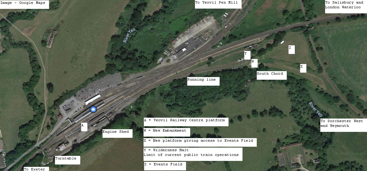
| Google Maps with our added notes. Public trains currently operate from Point A to Point Y. Once the project is complete Public trains will run from Point A to Point X (new platform) with access to the Events Field (Z) |
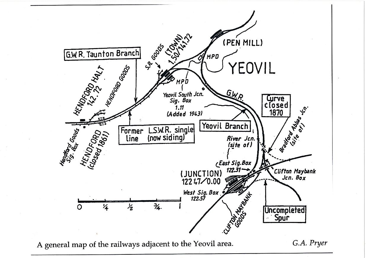
| Map showing the railways around Yeovil in the 1950's. The South Chord is the Uncompleted Spur at the bottom right. (Map by G.A. Pryer) |
| BACK |